Test

SPLIT ROCK LIGHTHOUSE STATE PARK

Lighthouse on cliff against pink sky
Dr.Jelieta M. Walinski/P&TC Photo Contest
Heather Kick-Abrahamson/P&TC photo contest
huge wave splashing against cliff with lighthouse
Matthew Herberg / P&TC photo contest - 2018

About the park

Split Rock Lighthouse State Park pinpointed on MN
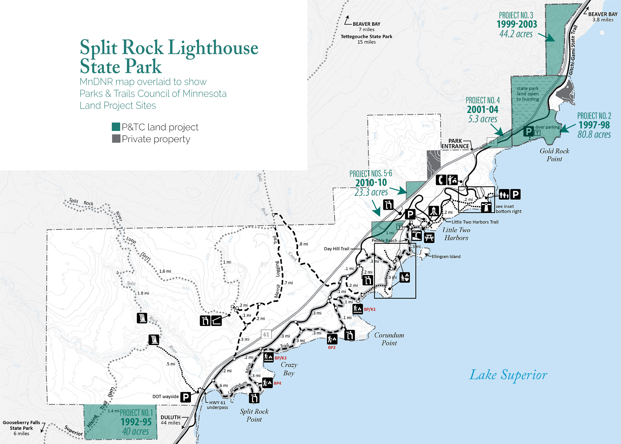
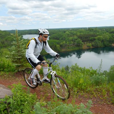
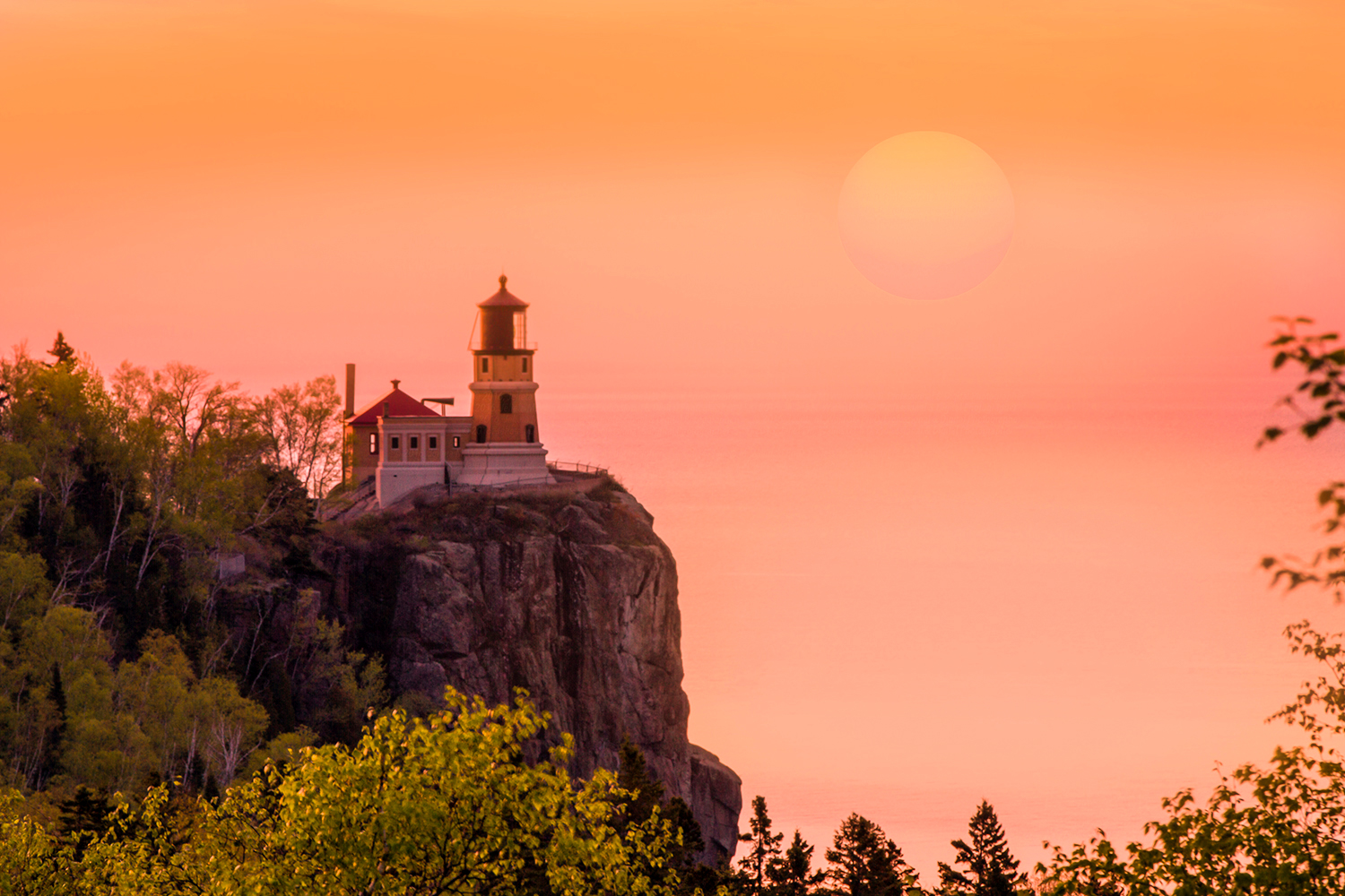
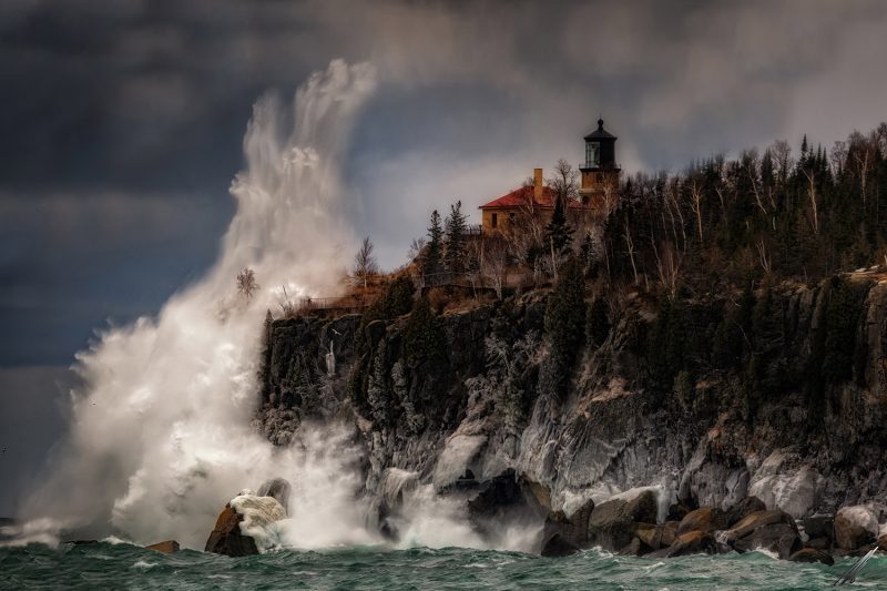
Most Minnesotans are familiar with the historic lighthouse perched atop the rocky cliff overlooking Lake Superior, seeing as it is often included in top lists of lighthouses in the nation. Yet, there is so much more to explore in this state park, including 12 miles of scenic hiking trails and 8.7 miles of fat tire bike trails. The paved Gitchi-Gami State Trail also runs through the park and can be ridden from here to Goosebery State Park in the south or north to Beaver Bay.

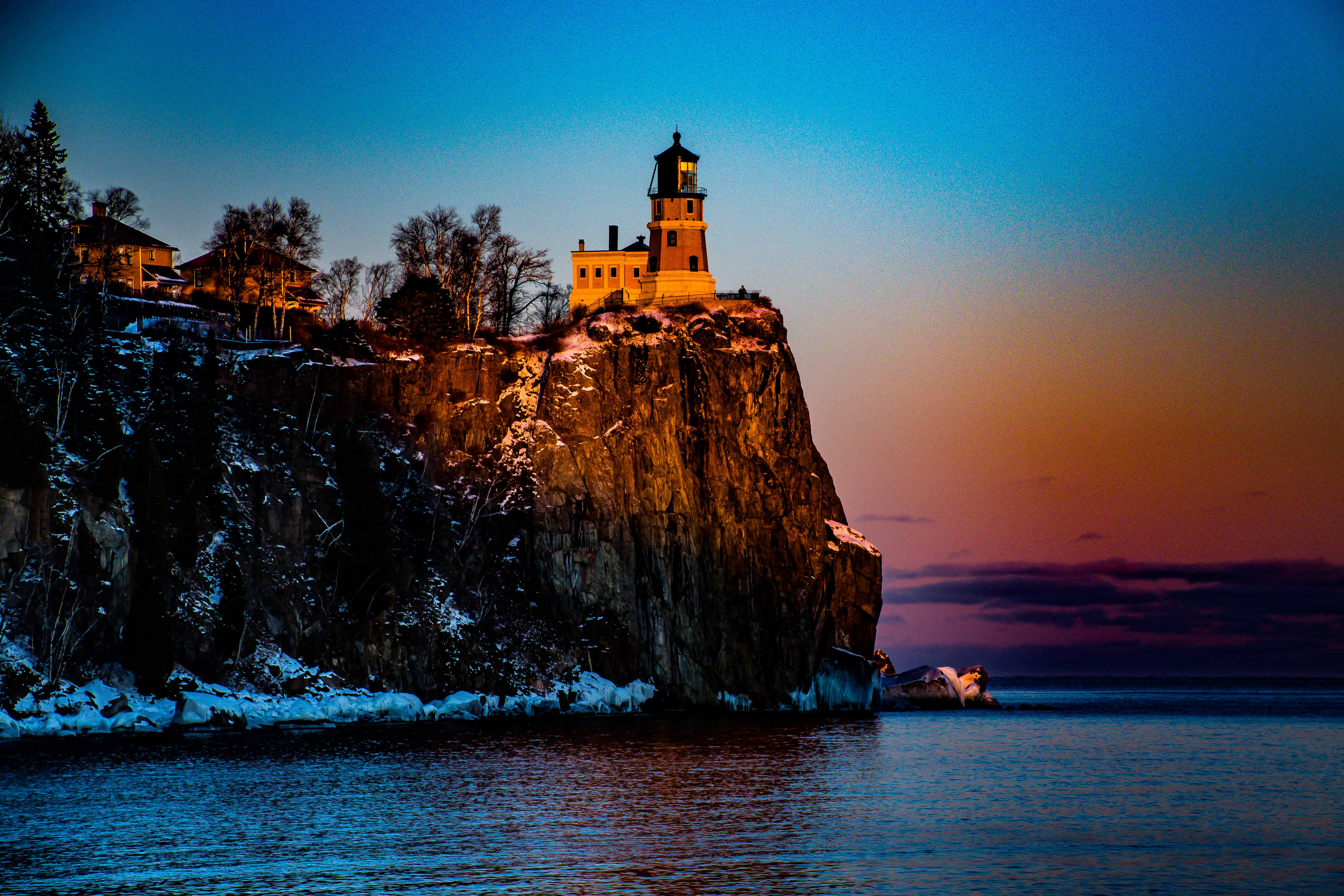
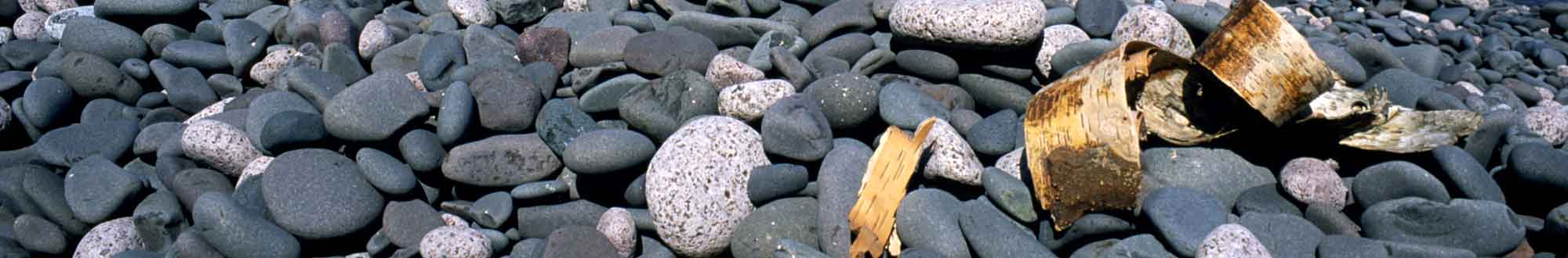
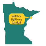
Pebble Beach, located near the picnic area is a unique beach where pebbles—smooth, fist-sized, basalt pebbles that clink together—take the place of the sand that you’d find at a typical beach.

Our Work by the Numbers

6

LAND PROJECTS
completed or
in progress here

274

ACRES
of invaluable
land saved

13%

PERCENT
of park acreage
saved by P&TC projects

$2,759,250

DOLLAR VALUE
of land at time
P&TC acquired

Park Map Showing Project Sites

Map of Split Rock Lighthouse with overlay

Our Project Stories

1) Forest Land for a Foot Trail

TIMELINE: 1992 - 1995

ACRES: 120

LOCATION: Southwestern border

VALUE: $58,000

In 1945 Judge C. R. Magney, who would go on to be a founder of Parks & Trails Council, noticed a sign near the Baptism River reading “Lake and River Frontages for Sale.” Needing no further incentive, he went to work protecting this land by successfully lobbying for the creation of Split Rock Lighthouse Wayside. Initially just 35 acres, it wasn’t until 1967 that the legislature authorized its expansion to 1,872 acres and changed the designation to a state park.

Building on this history, in 1992 Parks & Trails Council acquired 120 acres for the park’s southern border where the Superior Hiking Trail traverses. This project was part of a much larger project where we acquired an additional 840 acres just outside the border of Split Rock Lighthouse, from the same landowner. Years later the 840 acres were exchanged with Lake County for land they owned in George H. Crosby Manitou State Park (see that park for details).

2) Saving Gold Rock point

TIMELINE: 1997 - 1998

ACRES: 80.8

LOCATION: Gold Rock Point

VALUE: $1,166,000

Gold Rock Point is a rugged, lichen-covered cliff along Lake Superior, viewable from the Lighthouse. It offers the primary point where underwater divers can access the Madeira shipwreck. In 1997 the private landowners offered to sell Gold Rock Point and the surrounding land to P&TC for $1 million. We immediately launched a fundraising campaign and began lobbying the Minnesota Legislature to expand the park boundaries to include this land. We also mobilized public support to persuade the Lake County Board of Commissioners to approve the sale. Thanks to these efforts, which included many dedicated individuals and foundations, Gold Rock Point is today part of Split Rock Lighthouse State Park.

3) Lake Superior Ridgeline

TIMELINE: 1999 - 2003

ACRES: 44

LOCATION: Northeastern tip

VALUE: $600,000 (mostly donated by landowner)

The effort to save this land gained urgency when, in 1998, our then-president Nadine Blacklock was killed in a car accident nearby. This tragedy occurred while we were in the midst of negotiations. The landowners agreed to sell significantly below market value as they were motivated to see it protected in its natural state. By 2003 we successfully lobbied to expand the park boundary and conveyed the parcel to the DNR.

4) Connecting Key Shoreline

TIMELINE: 2001-2004

ACRES: 5.3

LOCATION: Adjacent to Gold Rock Point

VALUE: $446,250

This was the last remaining private shoreline between Gold Rock Point and the lighthouse. It had been developed with four cottages around 1937, nearly ten years before Split Rock Lighthouse was established as a wayside, later to become a state park.

In the early 2000s this area was a hot-spot for residential development and the landowner became interested in selling. P&TC worked diligently to acquire the land, then relocated the cottages to a private property nearby. The Gitchi Gami State Trail was later built using both this property and the adjacent Gold Rock Point property we helped acquire for the park years earlier.

5-6) Trading Post Overlook

TIMELINE: 2010-2010

ACRES: 23 acres (2 projects)

LOCATION: Overlook along Hwy 61

VALUE: $1.1 million

In the middle of this State Park was a privately owned, kitschy tourist attraction called Split Rock Trading Post. Once a popular stopover located on highway 61, many tourists paid the dime admittance to climb the wooden tower and see the lighthouse.

Around 2000, a fire claimed the shop and it never reopened. Then, in 2010, with a planned highway re-alignment, the owners sold the property to P&TC. We immediately conveyed it to the state park and it was developed into a wayside overlook.

In conjunction with this project the landowner sold to P&TC a small 4.7-acre undeveloped property a quarter-mile up the road, which we conveyed to the park at the same time.

Land Projects at Other Parks or Trails

Tour more of the land projects we’ve undertaken for parks and trails.

Related Projects