Final Bill » Law
Bonding Bill S.F.No. 3168
Session Law Chapter 186, Section 8: Additions to State Parks

Project included in Parks & Trails Council’s 2018 Legislative Agenda
Bonding Bill S.F.No. 3168
Session Law Chapter 186, Section 8: Additions to State Parks
Subdivision 1.
[85.012] [Subd. 21.] Frontenac State Park, Goodhue County.
The following area is added to Frontenac State Park, Goodhue County:
That part of the Northeast Quarter of Section 10, that part of the Southeast Quarter of Section 10, that part of the Northwest Quarter of Section 11, and that part of the Southwest Quarter of Section 11, all in Township 112 North, Range 13 West, Goodhue County, Minnesota, described as follows:
Commencing at the east quarter corner of said Section 10; thence on an assumed bearing South 00 degrees 25 minutes 27 seconds East, along the east line of the Southeast Quarter of said Section 10, a distance of 1,654.63 feet; thence South 89 degrees 34 minutes 33 seconds West, a distance of 2,219.43 feet to the point of beginning of the land to be described; thence North 19 degrees 04 minutes 33 seconds East, a distance of 3,905.90 feet to the centerline of Hill Avenue; thence southeasterly, along said centerline, to the northwesterly right-of-way boundary of County Road Number 2, as designated on Goodhue County Highway Right-Of-Way Plat No. 25, as recorded in the Goodhue County Recorder’s Office; thence southwesterly along said northwesterly right-of-way boundary and along the northwesterly right-of-way boundary of County Road Number 2, as designated in Goodhue County Highway Right-Of-Way Plat No. 24, and along the northwesterly right-of-way boundary of County Road Number 2, as designated in Goodhue County Highway Right-of-Way Plat No. 23, to the intersection with a line bearing South 76 degrees 25 minutes 27 seconds East from the point of beginning; thence North 76 degrees 25 minutes 27 seconds West, a distance of 907.89 feet to the point of beginning.
EXCEPT that part lying within the boundaries of the following described parcel:
That part of the Southeast Quarter of Section 10, Township 112 North, Range 13 West, and that part of the Southwest Quarter of Section 11, Township 112 North, Range 13 West, Goodhue County, Minnesota, described as follows:
Commencing at the northeast corner of the Southeast Quarter of said Section 10; thence southerly on an assumed azimuth from North of 179 degrees 34 minutes 33 seconds, along the east line of the Southeast Quarter of said Section 10, a distance of 1,100.31 feet; thence westerly 269 degrees 34 minutes 33 seconds azimuth, a distance of 80.53 feet to the point of beginning of the land to be described; thence northerly 340 degrees 42 minutes 19 seconds azimuth, a distance of 300.00 feet; thence easterly 100 degrees 22 minutes 46 seconds azimuth, a distance of 286.97 feet to the centerline of County Road Number 2, as now located and established; thence southerly and southwesterly, along said centerline, to the intersection with a line drawn southerly 160 degrees 42 minutes 19 seconds azimuth from the point of beginning; thence northerly 340 degrees 42 minutes 19 seconds azimuth, a distance of 51.66 feet to the point of beginning.
EXCEPT that part lying within the boundaries of the following described parcel:
That part of the Southeast Quarter of Section 10, Township 112, Range 13, Goodhue County, Minnesota, described as follows:
Commencing at the northeast corner of said Southeast Quarter; thence southerly, on an assumed azimuth from North of 179 degrees 34 minutes 33 seconds, along the east line of said Southeast Quarter; a distance of 1,491.88 feet; thence westerly 269 degrees 34 minutes 33 seconds azimuth, a distance of 870.79 feet to an iron pipe on the centerline of County Road Number 2, as now located and established, being the point of beginning of the land to be described; thence northerly 24 degrees 07 minutes 23 seconds azimuth, a distance of 132.28 feet to an iron pipe; thence northwesterly 301 degrees 14 minutes 43 seconds azimuth, a distance of 524.46 feet to an iron pipe; thence southerly 180 degrees 51 minutes 58 seconds azimuth a distance of 342.82 feet to an iron pipe; thence southeasterly 118 degrees 29 minutes 28 seconds azimuth, a distance of 273.01 feet to an iron pipe on the centerline of said County Road Number 2, as now located and established; thence northeasterly along said centerline to the point of beginning.
EXCEPT that part described as follows:
That part of the Southeast Quarter of Section 10, Township 112 North, Range 13 West, Goodhue County, Minnesota, described as follows:
Commencing at the northeast corner of said Southeast Quarter of Section 10; thence southerly, on an assumed azimuth from North of 179 degrees 34 minutes 33 seconds, along the east line of said Southeast Quarter of Section 10, a distance of 1,100.31 feet; thence westerly 269 degrees 34 minutes 33 seconds azimuth, a distance of 80.53 feet to the point of beginning of the land to be described; thence northerly 340 degrees 42 minutes 19 seconds azimuth, a distance of 300.00 feet; thence westerly 250 degrees 42 minutes 19 seconds azimuth, a distance of 300.00 feet; thence southerly 160 degrees 42 minutes 19 seconds azimuth, a distance of 384.25 feet, to the northwesterly right-of-way boundary of County Road Number 2, as designated in Goodhue County Highway Right-of-Way Plat No. 23, as recorded in the Goodhue County Recorder’s Office; thence northeasterly, along said northwesterly right-of-way boundary, to the intersection with a line drawn southerly 160 degrees 42 minutes 19 seconds azimuth from the point of beginning; thence northerly 340 degrees 42 minutes 19 seconds azimuth, a distance of 10.01 feet to the point of beginning.
Subd. 2.
[85.012] [Subd. 21.] Frontenac State Park, Goodhue County.
The following areas are added to the Frontenac State Park, Goodhue County:
(1) all that part of Sections 31 and 32, Township 113 North, Range 13 West, in the County of Goodhue and State of Minnesota, described as follows:
All of Block 7, Wacouta Beach, in said Section 32 lying on the south side of and adjoining Lake View Drive and adjoining the south and west lines of said Section 32. Also that part of said Section 31 described as follows:
Beginning at the southeast corner of said Section 31; thence run North along the east line of said Section 31 a distance of 961.0 feet more or less to the southerly right-of-way line of Lake View Drive; thence run North 61 degrees 30 minutes West along the southerly right-of-way of Lake View Drive a distance of 170.0 feet; thence run South 34 degrees West 320.0 feet; thence run North 77 degrees East 125.0 feet; thence run South 13 degrees West 610.0 feet; thence run South 76 degrees West 600.0 feet; thence run South 88 degrees 30 minutes West 1,100.0 feet; thence run North 54 degrees 45 minutes West 1,140.0 feet; thence run North 37 degrees 15 minutes West 400.0 feet; thence run North 72 degrees West 1,000.0 feet; thence run South 89 degrees 45 minutes West 200.0 feet; thence run North 70 degrees 45 minutes West 250.0 feet to a point on or near the east right-of-way line of public road; thence run South 15 degrees 45 minutes West 720.0 feet along or near said east right-of-way line of public road to a point at or near the northerly right-of-way line of State Trunk Highway 61; thence run easterly along said northerly right-of-way line of State Trunk Highway 61 a distance of 2,050.0 feet more or less to the south line of said Section 31; thence run East 2,925.0 feet more or less along said south line of Section 31 to the point of beginning;
(2) the West Half of the Northeast Quarter of Section 6, Township 112 North, Range 13 West, EXCEPT THE FOLLOWING:
All that part of the West Half of the Northeast Quarter of Section 6, Township 112 North, Range 13 West, in Goodhue County and State of Minnesota, described as follows:
Beginning at the center of said Section 6; thence North 1,970 feet to the centerline of State Trunk Highway 61; thence southeasterly along the centerline of said highway for 335 feet; thence North 66 degrees 31 minutes East 380 feet; thence deflect to the left on a six degree curve for 570 feet to the south line of Borrow Pit No. 225; (Borrow Pit No. 225 being described in that certain Notice of Lis Pendens dated May 19, 1952, and recorded May 20, 1952, in Book 115 of Mortgages, page 77); thence East 430 feet to the east line of the West Half of said Northeast Quarter; thence South 2,250 feet to the southeast corner of said West Half of the Northeast Quarter; thence West 1,320 feet to the place of beginning. EXCEPTING from the above all rights-of-way of state highway and excepting the right-of-way of the railroad company.
ALSO an easement for right-of way purposes on a strip of land 50 feet in width adjoining and northwesterly of the northwesterly line of the above conveyed tract;
(3) that part of the Northwest Quarter of Section 6, Township 112 North, Range 13 West, Goodhue County, Minnesota, lying northeasterly of the northeasterly right-of-way line of the Canadian Pacific Railroad (formerly the Chicago, Milwaukee and St. Paul Railway Co.); and
(4) Block 8 and Block 9, Wacouta Beach, according to the plat thereof, on file and of record in the Goodhue County Recorder’s Office.
Expand the statutory boundary (boundary that indicates which lands can be purchased from willing sellers) of Frontenac State Park to include the 159 acres of restored blufflands that Parks & Trails Council purchased and is holding in trust for the park.
Additionally, funds were sought for the state to purchase the land (see that project here)
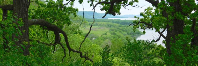
At the border of Frontenac State Park, near it’s entrance, lays land that holds outstanding natural beauty and a view to behold. In 2017 the owner put the land up for sale, thus presenting a small window of opportunity to protect this land for future generations to enjoy as part of the park. Parks & Trails Council began discussions right away, knowing that if the landowner sold to a private entity that would likely put an end to any future use as parkland, perhaps forever. This land holds a bluff overlooking the Pleasant Valley Creek and Lakelet as well as restored prairie and oak savanna lands.
While the beauty and location of this land makes it a natural addition for the park, it is currently outside the statutory boundary of the park. As such Parks & Trails Council is dedicated to leading the effort to incorporate this land into the boundary and park ownership.
Grassroots initiative in partnership with Frontenac State Park Association
| Amount Requested | Amount Funded |
| $900,000 | $0 - but the boundary was successfully adjusted |
