- Home
- P&TC Land Projects
- New segment of Paul Bunyan Trail Complete

New segment of Paul Bunyan Trail Complete
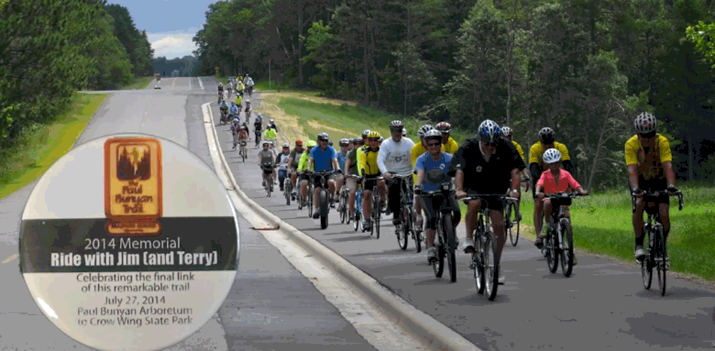
On July 27, a new 6-mile segment of the Paul Bunyan State Trail was opened to the public. This new segment extends the current trail south from the cities of Baxter and Brainerd into Crow Wing State Park. It is a scenic, meandering trail that follows the bluffs of the Mississippi River. It was a project that was many years in the making.
Terry McGaughey, a volunteer who initiated the idea of converting abandoned rail line into the current Paul Bunyan State Trail, also envisioned the trail extending into Crow Wing State Park. Such a segment presented significant challenges because the land was owned by multiple, private landowners. Each parcel of land within the corridor would need to be acquired (or easement secured) separately from willing sellers, with no parcel missed or the trail project would be stalled. This was different than how the majority of the land for the Paul Bunyan State Trail was acquired–from the sole ownership of the railroad.
Spurred on from McGaughey’s vision and the DNR’s commitment to develop this trail segment, Parks & Trails Council became involved with acquiring the land adjacent to the park. Between 2003 and 2006, P&TC acquired 144 acres within this corridor. The remaining land was acquired by the DNR from Potlach Corporation, a forestry company, in partnership with P&TC, Conservation Fund and The Nature Conservancy. In the end this multi-year effort added a unique opportunity for a forested trail corridor within Crow Wing State Park that follows the shoreline of the Mississippi River.
Crow Wing State Park now serves as the southern terminus of the Paul Bunyan State Trail. As the trail winds out of the park it connects to city trails that bring it into the cities of Baxter and Brainerd. Within Baxter, it connects with the completed Paul Bunyan State Trail–the longest, continously paved trail in the nation, according to the DNR.
While the city of Baxter will continue to maintain the trail section through the city, the DNR is working to provide State Trail signage to guide trail users along the route. An updated trail map is not yet available for this new connection. In the meantime, trail users can inquire with staff at Crow Wing State Park for directions to the trailhead within the park. Once the trail transitions onto city trails, users can use the Baxter City Trails map.
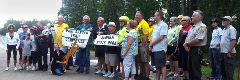
Numerous supporters have been instrumental in advocating and partnering to build the trail. Many of these supporters participated in the ribbon cutting on July 27, including:
Chip Borkenhagen of the Paul Bunyan Trail Association
Mayor James Wallin of Brainerd
Mayor Darrel Olson of Baxter
Roger Hellquist, Bemidji City Council Member
Rep. John Ward
Erika Rivers, Director of the DNR Division of Parks and Trails
Parks & Trails Council of Minnesota
Congressman Rick Nolan
Lia McGaughey, daughter of Terry McGaughey
About Lisa Filter
News Categories
Recent News
-
We have a new CRM December 11, 2024
-
Vote yes on Lottery proceeds October 29, 2024
-
Two Friends Groups receive ... August 28, 2024
-
Share your opinion on fundi... August 27, 2024
-
DNR Update: Next Steps in t... August 26, 2024
